Viewing the National Network
Horizons holds national datasets such as construction and condition data from HAPMS, as well as other data such as Reference Marker posts, Overbridges, and STATS 19 Accident. All Layers in the system are built to display national data where possible. Interacting with national data requires the complete HE Network to be selected: either NH Network or NH Network including DBFOs.
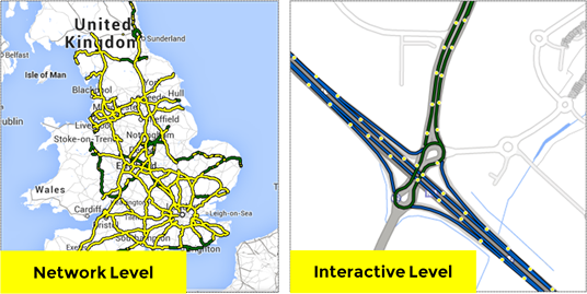
Selected Layers are presented onto the Network. When zoomed out to Network level, all data is presented as lines on the Network irrespective of the true geometric representation of the data (points, lines, and polygons). The screenshot on the left below shows a reference marker post Layer summarised at Network level. The individual markers can be seen when you zoom in.
Reference marker posts visualisations at Network and Interaction level
For details on how to switch Networks, see Viewing a Network.