Sections
The data presented at Network level is designed solely as a summary. You cannot interact with the data at Network level. To fully explore the data, zoom in to Interaction level and select a Section.
When you select a Section, the Information icon is enabled. Basic information about each Section is available, such as Section length and description. Graphing data and Imagery may also be available for the Section.
To select a Section use the following procedure:
- Zoom to Interaction level or search for the Section, so that the required Section is active as you hover the cursor over the Section.
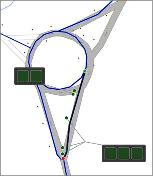
- Click the Section. The start and end points of the Section are marked with green and red circles respectively.The data Layers that you have selected are overlaid on the Section either as lines, points, polygons, or call-outs.
Navigating long map sections
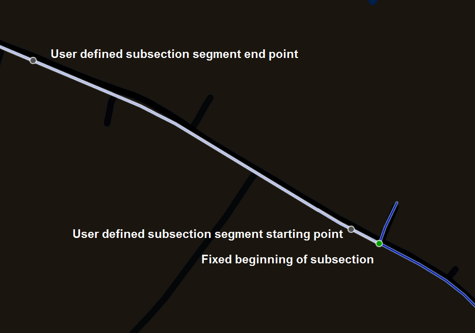
Sections of a Network that are longer than 2 km can be broken up into smaller, more manageable subsections that can be selected by clicking at any point along the highlighted section.
You can adjust the segment by dragging its start or end point. Or you can double click within the segment to move its centre point.