How Data is Organised
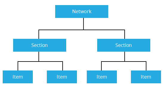
Data within the tool is organised hierarchically. At the top level of this hierarchy is the Network. Multiple Networks such as Regional and District Networks can be held in the system simultaneously. Each Network describes a distinct spatial representation of the roads in it. When you log in to the system, the default base Network is selected.
Each Network contains multiple Sections which are derived from PMS (Pavement Management System) data.
Data items are mapped against Sections using the spatial references defined in the data source.
As you zoom into the Network, the Sections become interactive and selectable at a set zoom level. When a Section is selected, the associated data items are available for interaction within the map.
You can select all available Network and data Layers from the Layers icon.