Uploading a GIS Data File
You can upload GIS files in MapInfo (.tab) or ESRI (.shp) file formats.
For the full file upload procedure, see Uploading a Data File.
To upload a bundle of GIS files for .shp or .tab import
- Go to Management > Data Import > Import Data.
- Enter a name for the data file and click OK.
- Select GIS input type.
- Click Add File(s), then multi-select all of the files to upload.
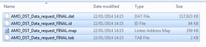
- Click Open. The files are uploaded and the file status is displayed.
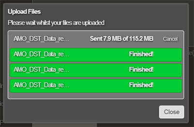
- When all files show Finished, click Close. The Configure Data Import window shows only a single master GIS file in the list of source files, e.g. the .tab file.
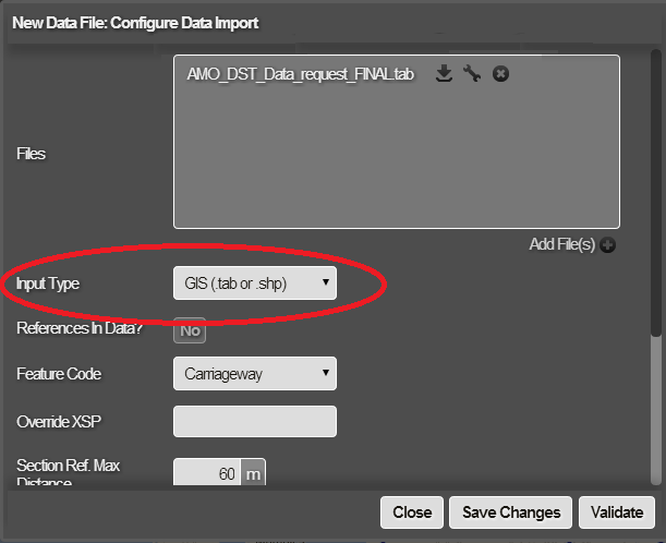
- Configure the rest of the data import settings as required. See Importing and Configuring a Data Import.
You can remove files by clicking the “x” button to the side of the file, and upload again as required.