Mapping Data Items with No Geometry
For a data item that includes coordinates (i.e. GIS and CSV With Geometry), the item geometry is used directly by Horizons map Layers. But for a data item with no geometry (i.e. Offset from the Section centreline). For items without geometry, if an item has a single chainage value, it is mapped as a point. If an item has a start and end chainage value, it is mapped as a line. If an item has no chainage, it is considered to be a line item that covers the whole length of the Section.
If an item includes an offset field, this is used along with the chainage to map either a point or a line copy of the network subsection alongside the Section. A positive offset maps the item to the right of the network Section. A negative offset maps the item to the left (in the direction of the Network Section).
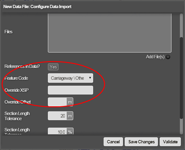
XSP and Feature Code, and the UKPMS Road Type for the Section. The Feature Code defaults to Carriageway but you can set the feature code for each item as part of the data import. UKPMS Feature Codes are supported, i.e. CW, FW, KB, CT, VG, and CI. You can change the feature code in the Configure Data Import window. See Importing and Configuring a Data Import.
If no XSP field or Feature Code is defined for any item, you can set these for the whole dataset.
If no XSP or Offset is defined, the default is Centreline XSP (CC). This means that all items are mapped onto the Section centreline.
The Configure Data Import window showing the item mapping settings: