Layers
Put data on the map
Networks and data are available to view on the map as Layers. Horizons can hold and present many distinct data sources as data Layers organised under the Layers dropdown.
When you select a Network, the Network is placed centrally within the map. You then select the various Layers of spatial data that you want to see overlaid on the Network map.
The Layers dropdown
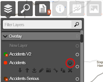
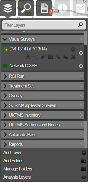
Data Layers in the system are organised into folders. Each folder can contain multiple data Layers. You can create and edit layers.
To see the Layers within a folder, click the folder name. The Layers within the folder are expanded. To close the expanded list of Layers, click on the folder name again. An arrow to the left of the folder name indicates whether the folder is expanded or collapsed.
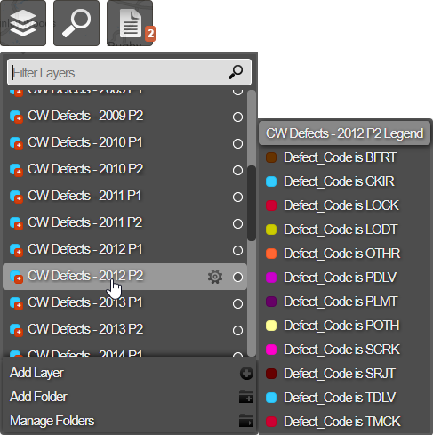
Hover over a Layer name to see a description (legend) of the data that is provided by the Layer. If more than one Layer is active, hovering over a Layer name will isolate the selected Layer on the map.
Access to some Layer features may be limited by licence or Administrator designation. See Setting User Permissions.
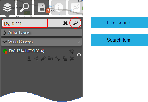
Searching for a Layer
You can search for a specific Layer if you know all or part of the Layer name:
-
Click the top Layers icon.
-
In the Filter Layers search box at the top of the dropdown, enter all or part of the Layer name.
-
Click the Search button or press Enter.
The Layers that contain the search term are listed within their folders.
Layer Options
Each Layer has a menu of actions to perform on the Layer, for example to download, edit, move, rename, share, and delete a Layer. Not all options are available on all Layers and for all users. Layers that derive from survey and other primary data sources and from merged sections are not editable.